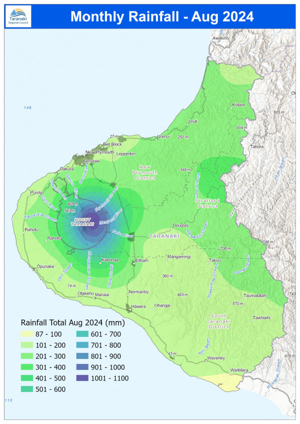
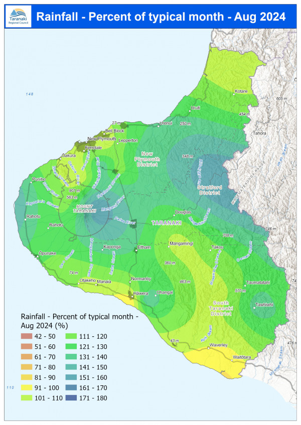
August finally bucked the trend for lower than average rainfall in Taranaki this year with 210.8mm or 22% more than usual, with our gauge at the Pohokura Saddle in the Eastern Hill Country recording 59% higher than normal.
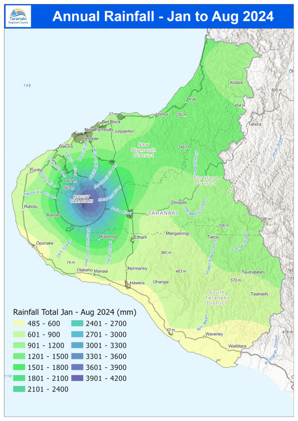
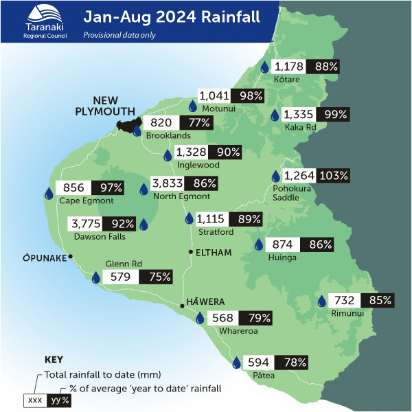
That monthly downpour means the Pohokura Saddle now has just 3% more than normal rainfall for the year, with all of our monitoring stations below the typical average, with Waitotara at Hawken Rd at 37% less rainfall than normal. On average there has been 15% less than normal across all rain gauges.
Mean river flows for August were 17.6% lower than typical values, low flows were 7.9% greater, and high flows 27.5% greater than typical values. The maximum river flow recorded was 698.2 m3/sec at Waitara at Bertrand Rd, on 27 August after heavy rainfall at the month. Mean river (non-mountain) water temperatures were 10°C, an average of 0.1°C cooler than long-term August values.
The average air temperature for the region (excluding Te Maunga sites) was 10.8°C, which is 0.8°C warmer than long-term August averages. The maximum air temperature recorded in August was 20.46°C at Weraweraonga at 749 Mangawhio Rd, on 31 August.
August average wind speeds were 15.3km/hr, with average gust strength of 45km/hr, these were 2.6km/hr stronger, and 3.2km/hr gustier than the long-term average. The maximum wind gust recorded in August was 115.7 km/hr at Taungatara at Eltham Rd, on 31 August
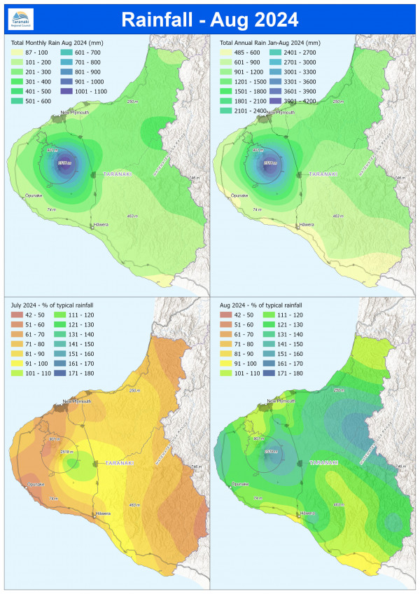
August 2024 rainfall maps
What you should know:
- The site maps show data from a selection of the sites we monitor, but not all of them.
- The distribution maps are based on mathematical modelling and may not accurately represent actual rainfall in some unmonitored areas.
- This is raw data and may not have been subjected to a quality control process. All efforts are made to ensure the integrity of the data, but the Council cannot guarantee its accuracy, or its suitability for any purpose. See the full terms and conditions for the use of environmental data(external link).
MONITORED SITES

RAINFALL DISTRIBUTION