The mauri and health of our rivers and streams are highly valued and are vital to the well-being, livelihood and lifestyle of everyone in the Taranaki region.

David MacLeod.
There is plenty of interest and public discussion around the water quality in our rivers and streams. And so, as the manager of the freshwater resource, the Taranaki Regional Council closely monitors waterway quality to ensure that the discussion, as well as the Council’s own decision making, is well informed by fact and science.
The Taranaki Regional Council has been closely monitoring water quality across Taranaki for more than two decades. The overall picture that has emerged in recent years is that Taranaki’s freshwater quality is generally very good by national and international standards and comparisons, and compares well with other catchments of a similar nature around New Zealand.
The latest trends for over 20 years of monitoring ecological health and the physical and chemical state of our rivers and streams show most measures are improving or not changing significantly, and in-stream life is again the best since our measurements began.
This is no accident. The Taranaki community continues to invest heavily in measures that protect and enhance the region’s waterways. The benefits are now becoming more apparent and the Council remains firmly focused on working with the Taranaki community to continue improvement in the region.
I invite you to read this report on the most recent findings of Council’s extensive water quality monitoring programmes. The programmes are designed to accepted protocols and subjected to external review and audit to ensure their scientific integrity. This report card is based on detailed scientific reports which you can access from this page.
- Across the region, ecological health of waterways in more and more rivers is once again the best ever recorded since monitoring began.
- Monitoring shows that, in general, water quality across the region is either improving or not showing any significant change.
- Excluding the two sites contaminated mainly by birds, 94% of all samples from freshwater recreational sites met the Ministry for the Environment bathing guidelines during summer monitoring.
- When people are likely to be swimming, the Waitara River almost always meets the health guidelines for safe swimming during summer.
- In 2016/17, 99% of samples were within the Ministry for the Environment bathing guidelines for coastal beaches.
- Water quality in the region is ‘fit for purpose’ by almost all measures within the compulsory national criteria at almost all sites most of the time, and is usually in the highest category.
- Of the 14,900 km of ringplain streambank, 85% (12,685 km) is now fenced and 70% (8,003 km) protected with riparian vegetation.
- The state and trends of our rivers compare well with equivalent catchments elsewhere.
- No freshwater sites in Taranaki were showing significant increases in any forms of nitrogen.
Across the region, ecological health of waterways is improving or not showing any significant change, and in more and more rivers is the best ever recorded (since monitoring began in 1995).

- It is very important that our rivers and streams support good ecological health. We use a national ecological index based on the macroinvertebrate communities (tiny animals including insects, crustaceans, molluscs, worms and leeches) found in waterways to measure ecological health.
- The Council has a clear picture of ecological health across the whole region. Since 1995, it has analysed thousands of samples from 59 key sites on 26 rivers and streams. The surveys are done during spells of settled low flows and fine weather, in spring and again in summer, when stream communities would be under the greatest stress.
- The trends in the latest results (for the 21 years to June 2016) are the best ever recorded. They show improving stream health at 46 (78% of total) sites – an increase from 44 sites the previous year. There are indications of decline at seven sites – one less than the previous year. So we have more than six times as many sites with indications of improvement as there are deteriorating.
- A more rigorous statistical analysis reveals an ‘almost certain’ trend of a significant ecological improvement at 25 sites (up from 15 three years earlier); a ‘very likely’ positive trend at five sites; and only one site showed a ‘very likely’ significant decline (most likely due to erosion on Mt Taranaki).
Measuring organic contamination, nutrient concentrations and aesthetic quality can flag pressures on waterways and indicate where to best focus our attention. The picture in Taranaki is larely stable but our aim to achieve more improvements and fewer declines.

- Samples are collected year round, regardless of flow and weather conditions, and analysed for a wide range of parameters.
- Latest results are for the 2015/16 year, when 11 sites were sampled monthly for up to 22 parameters.
- Measurements of organic contamination and aesthetic quality at all sites are not changing significantly.
- The latest seven-year trend is more positive than the long-term period, with fewer sites and measures showing significant deterioration, particularly in nutrient concentration.
- Indicators of phosphate and nitrogen levels are steady or improving at 73% and 91% of the sites, respectively.
- Over the 21-year period, the indicator of total nitrogen showed mostly stable at seven sites, improvement at three sites and deterioration at one site.
- While nitrogen can be linked to water quality issues under some circumstances, monitoring has found no association between nitrogen levels in Taranaki’s streams and the ecological health of our waterways.
Algae, or periphyton, is essential for aquatic ecosystems but excessive levels can cause environmental and/or health problems. Just about all of Taranaki's monitored sites meet national guidelines.

- The Council monitors long strands (filaments) and mats of periphyton at 21 sites.
- The latest trend results (for the 2015/2016 year) show the extent of algae for long strands (filaments) and mats improved at two sites each and remained stable at the remaining 19 sites.
- 94% of the surveys for all sites over the last two years (2014-2016) met national periphyton guidelines. These surveys were conducted when environmental conditions favoured excessive algal growth. At other times algal growth would have been less.
The Government has imposed compulsory measures and grades which apply to various uses of water, through the National Policy Statement (NPS) for Fresh Water Management. Grades ‘A’, ‘B’ and ‘C’ indicate quality from best to acceptable; ‘D’ is unacceptable and improvement in water quality is required.

Comparison of the region’s water quality data with the national standards across the 11 separate monitoring sites, shows that for 55 measures: 38 (69%) are in the ‘A’ category, 15 (27%) are ‘B’, and there is one ‘C’ category rating. Only one is below the national bottom line for acceptable water quality (‘D’). By these standards, water quality in the region is ‘fit for purpose’ by almost all measures within the compulsory national criteria at almost all sites most of the time, and is usually in the highest category.
| VALUE | Ecosystem health | Secondary recreation |
|||
| MEASURE & PURPOSE | Nitrate-N Limit on toxicity |
Ammoniacal-N Limit on toxicity |
E. coli Public health |
||
| SITE | Typical |
Worst |
Typical | Worst | Typical |
| Maketawa @ Tarata Rd | A | A | A | A | B |
| Mangaoraka @ Corbett Rd | A | A | A | B | D |
| Waiwhakaiho @ SH3 | A | A | A | B | B |
| Stony @ Mangatete Rd | A | A | A | A | A |
| Punehu @ Wiremu Rd | A | A | A | A | A |
| Punehu @ SH45 | B | B | A | B | C |
| Waingongoro @ Eltham Rd | B | B | A | B | A |
| Waingongoro @ SH45 | B | B | A | B | A |
| Patea R. @ Barclay Rd | A | A | A | A | A |
| Patea R. @ Skinner Rd | A | A | B | B | A |
| Mangaehu @ Raupuha Rd | A | A | A | A | A |
In Taranaki most people swim at the beach rather than in rivers. The Council monitors the quality of seawater at popular coastal beaches every summer. Results are consistently better than the national average. In 2016/17, 99% of samples were within MfE guidelines. Opunake beach had the best quality. Bell Block beach showed the highest level of bacteria, but the median and maximum at Bell Block were still well within the guidelines.
Water quality at popular river bathing spots is far better than in the 1960s and 1970s, when waterways were routinely contaminated with partially treated municipal sewage and/or raw, untreated dairy effluent. Today, wildfowl and gulls are the major source of contamination at the few freshwater sites that routinely exceed health risk guidelines.

- The Council monitors freshwater quality at popular recreational spots every summer (where and when people are likely to swim), with slight variations in locations over a three-year cycle. Bacteria levels are measured at most sites, and cyanobacteria (blue-green algae) levels at a few sites.
- This year, additional weekly monitoring regardless of weather and river conditions was carried out at four most popular sites – Lake Rotomanu, Waiwhakaiho River at Merrilands Domain and Kaupokonui and Waingongoro river mouths.
- In summer 2016/17, 86% of all samples met the Ministry for the Environment recreational water quality guidelines for bathing water.
- Wildfowl and gulls are the major source of contamination at the two sites found to routinely exceed the guidelines near the mouths of the Waiwhakaiho River and Te Henui Stream. Excluding these two sites contaminated by birds, 94% of all samples met the MfE bathing guidelines. Further upstream, on the outskirts of New Plymouth, the Waiwhakaiho River met the swimming guidelines in 100% of the samples.
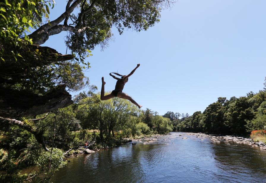
People expect to be able to swim safely in our lakes, rivers and coast and the Taranaki Regional Council monitors popular swimming spots each summer. Monitoring shows that overall the health risk from swimming in most places, most of the time, is very low and well within national guidelines.
All natural water bodies contain bugs (pathogens) that can make us sick. And the more bugs, the greater the likely health risk. There is no particular level of pathogens where a ‘swimmable’ river becomes ‘unswimmable’, or ‘safe’ becomes ‘unsafe’. The health risk is a sliding scale. Water bodies in any setting anywhere will also get occasional spikes.
Regional and district councils use national (Health and Environment Ministries) guidelines to inform the public of the health risk to swimmers. The guidelines are highly precautionary and based on the health risks for the most vulnerable in the community. Some rivers described as ‘unacceptable for bathing’ in NZ would be considered ‘good – acceptable for bathing’ under European standards.
It is not possible to maintain micro-organisms at very low levels all of the time in all water bodies, but the investment by local communities in upgraded sewage collection and treatment systems, and by farmers fencing and planting streambanks to control stock access and reduce pasture runoff go a long way to improving water quality in Taranaki.
During heavy rain and high flows many rivers can be dangerous and may contain debris, sediment and pathogens in runoff from homes, streets and farms or overflows from town and residential sewerage systems. To decide where and when it’s safe to swim, you should check the Taranaki Regional Council website, district council websites or the Land Air Water Aotearoa (LAWA) website and use common sense based on what you can see from the riverbank. As a precautionary approach, people should generally avoid swimming in rivers and lakes for three days after heavy rainfall.
- The region’s communities, industries and farmers make major investments in measures that protect and enhance the environment – principally our rivers and streams.
- Farmers are voluntarily investing an enormous amount of money and time to ensure waterways on the Taranaki ring plain are protected with fences and vegetation. The target is to complete the Riparian Management Programme by 2020, with an estimated $80 million spent on plants, fencing and contractors since the project began.
- The riparian programme has no equal in New Zealand and is transforming the region’s landscape as well as protecting and enhancing waterway quality. The programme covers 14,900 km of streambank mainly on the ring plain with 85% (12,685 km) now fenced, 70% (8,003 km) protected with riparian vegetation and includes 99% of Taranaki’s dairy farmers. Over 4.6m plants have been supplied over the life of the programme.
- The Taranaki Regional Council has a comprehensive programme to monitor all resource consent holders, which consistently reveals a generally high rate of compliance with consent conditions across all sectors,
- Non-compliance with consent conditions, and pollution complaints are thoroughly investigated by Council and appropriate enforcement action is taken.

Riparian protection satus at September 2017. Progressively darker shades indicate increased protection.
 The Waiokura is part of a national project which showcased five ‘best practice dairy catchments’ from around the country – two in the North Island and three in the South Island. The project started in the mid 1990s and is conducted by researchers from NIWA, AgResearch, DairyNZ and the Regional Councils.
The latest findings, published in the Journal of Marine and Freshwater Research, showed:
- Waiokura had the greatest improvement in ecological health with increases in the proportion of sensitive species through time following extensive riparian fencing and planting as well as irrigation of dairy farm effluent to land.
- Significant improvement in water quality indicators measured i.e. nitrogen, suspended solids, bacteria levels and water clarity.
- 90% of the 115km of streambank along Waiokura is now protected with fences and almost 70% is protected with vegetation.
- 67% reduction of direct discharges of treated dairy farm effluent into the stream. Two third of the catchment’s consented dairy discharges are now to land or primarily to land, and conversions to land disposal will continue as consents are renewed
- Increased on-farm productivity in the catchment in terms of milks solids per hectare (up to 21%) and milk solids per cow (up to 31%) at the same time as stream health.
- The study cautioned against making too much correlation between ecological stream health and nitrogen levels. The relationship between nutrient levels and ecological health is a complex issue and the study suggests that seasonal factors may be a stronger influence on both attributes.
- The results of the study validates the consistent approach taken by the Council and are a vindication of the investment and effort by the farmers to continue and complete the riparian planting and fencing and the conversion of the remaining dairy farm effluent to land.
The Taranaki Regional Council is continually adapting and refining its approach to freshwater management to ensure further protection and enhancement of Taranaki’s waterways.
Good progress is being made through the Council’s current programmes, policies, strategies and rules to achieve these objectives — regional initiatives such as the switch to land-based treatment and disposal of dairy effluent, and completion of Taranaki’s Riparian Management Programme. A new Regional Freshwater and Land Management Plan for Taranaki, however, is a number of years away, as the Council awaits finalised Government decisions and initiatives.
- Well-qualified, experienced scientific and technical staff deliver the Council’s environmental monitoring programmes.
- The Council carries out water quality analysis in its own laboratory with International Accreditation New Zealand (IANZ) accreditation.
- The Council’s ecological health monitoring of rivers is subject to both internal and external Quality Assurance checks
- The Council’s environmental monitoring programmes are designed to accepted protocols and are subjected to external peer review and audit, to check that the right things are being measured in the right places and in the right ways at the right time.
The scientific moniitoring results referred to in this report are available on this website or by contacting the Council - see the Related Links and Contact Us sections on this page. An overview of this report and those from earlier years are also downloadable in PDF format.